
Page 145 - AC/E Digital Culture Annual Report
P. 145
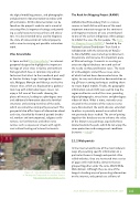
the digital modelling process, and photographic and planimetric documentation to videos with 3D animations. All this documentation can be found on the project’s website and is aimed at stressing Africa’s important heritage and provid- ing a useful resource to researchers and educa- tors. It is also intended to be used to diagnose the state of conservation of cultural property with a view to carrying out possible restoration work.Vilas AmuralladasIn Spain we nd Vilas Amuralladas,91 an internet geoportal designed to highlight the important heritage of a few cities in Galicia and northern Portugal which have in common city walls or fortresses that attest to their medieval past and/ or frontier history. Lugo, Santiago de Compos- tela, Melgaço, Monção and Valença are the ve chosen cities, which are displayed on a geoloca- tion map with information layers. Users can enjoy a full view of their walls showing the places of interest, leading to a 360-degree tour and additional information about the forti ed structures and existing stretches of the walls, which are sometimes only partly preserved. This geo-portal also o ers layers of information about each city, classi ed by historical periods (medie- val, modern and contemporary), religious archi- tecture, civil architecture and other nerve centres such as squares or streets with signi - cant cultural heritage of interest to tourists.The Rock Art Mapping Project (RAMP)Ukhahlamba-Drakensberg Park is a nature reserve in South Africa with one of the most important mountain ranges on the continent and important remains of cave art attributed to one of the earliest indigenous ethnic groups to inhabit the area, the San people. The Rock Art Mapping Project (RAMP),92 funded by the National Lottery Distribution Trust Fund in collaboration with the University of KwaZu- lu-Natal (UKZN), was started up to document, disseminate and conserve this important piece of African heritage. It consists in creating an extensive digital database to record each of the nearly six thousand known caves. The team of archaeologists visited these caves, someof which had not been documented since the 1970s, to carry out exhaustive documentation us- ing 3D laser scanning techniques enabling them to create digital models. Finally, the geographic information system (GIS) was used to map the region and locate each of the caves, providing digital photographs, virtual visits and 360-degree videos of them. What is more, not only caves situated in the environs of the nature reserve were documented; the work also was extended to others in privately owned areas which hadnot previously been studied. The aim of putting together this database was to enhance the value of the known cave paintings, especially those located outside the park, which do not enjoy the same protection and management conditions [resource - video].932.1.2 Web portalsIn the internet world, one of the most coherent ways of presenting speci c information on a particular theme is through web portals. Also called websites, they are structured into a series of pages with multimedia elements that are grouped together under the same World Wide Web domain. Although they are one of the longest-standing ways of presenting information on the internet, web portals are still one ofFigure 06 - Vilas Amuralladas. Interactive map of Santiago de Compostela. Screenshot. Source: http://www.vilasamuralladas.eu/es/AC/E DIGITAL CULTURE ANNUAL REPORT 2017145The use of digital technologies in the conservation, analysis and dissemination of cultural heritage
